WEST DHAULAGIRI LOWER Trek
- Duration:22 Day(s)
- Destination:Nepal
- Grade:Technical Challenging
West Dhaulagiri Lower Trek, a camping based trekking, lies between Bheririver and Kaligandaki River; actual location is between west to the Dhaulagiri Round Trek and east to the Jangla Pass. This trek was discovered on June 3 – 20 August, 2015 by Mr. Man Bahadur Khatri, who has been working in the sector of exploration of new trekking areas and climbing virgin mountains; is also a main contributor of our travel company.
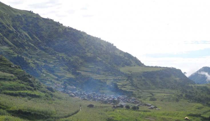
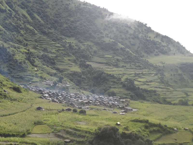
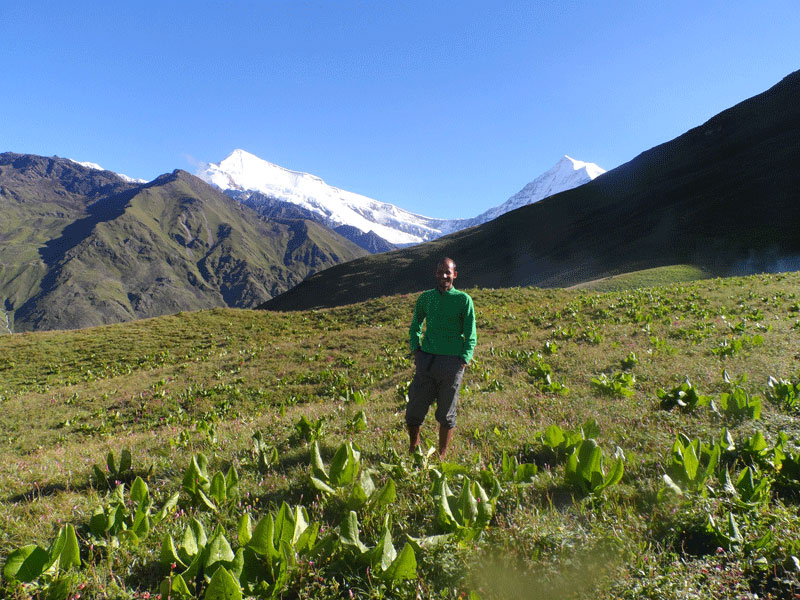
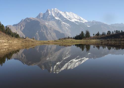
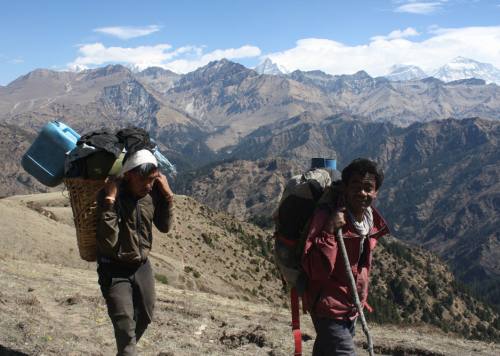
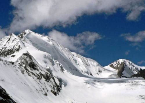
This trek follows Modi – GurjaKhani – Marmi Parmi - Chaluke and Lamsar - Pupalphedi. On the way, we will have the opportunities to see local peoples’ culture, pasture lands on the mountain laps, herbal fields, cattle grazing and, the closest views of various mountains: Gurja, most parts of Dhaulagiri Range (8172 m), Churen (7371 m), Putha (7246 m), Dogari (6536 m), Samjang (5924 m). Most of the time during the trek, we will be at the alongside of various mountains. Gurja Khani, also known as the Hidden Valley was famous for extracting copper from its ores that attracted Chhantyal and Bishwakarma (under ethnic: Kami) around 70-80 years ago. These days we will be able to enter a few of the old mine tunnels. Farming and herding are the main occupation for living of Chhantyal, Bishwakarma and the people of Baglung, Myagdi and Rukum districts. In summer, many people ascend to high pasture lands along with herds and, in winter they descend to temporary dwelling zone at the Dhaula Canyon. Another beautiful cultural village, Maikot, reflects an ancient fort of Magar clan along with their Kham Culture. The enriched ethnic also reveals the unique old culture besides that of new generations of Magar. Kham, a subgroup of Magar has a separate culture with unique language of the Tibetan- Burman Family. Kham culture has the profound recognition in the society.
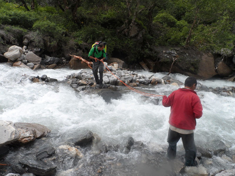
This trek is challenging one because, we need to pass through many high ups (around1500 m) & downs (around 1000 m) paths and, need to cross 3 passes with high grades above elevation of 4500 meters and, also sometimes through the rivers where bridges are not available instead of which only logs are kept for crossing the it. While we are on the journey, we really need to be fit with mentally& physically both because, the way is really narrow, sometimes rock cliffs and sometimes confusing ways due to bushes and need to make navigation of the paths between the passes and take help of local guides.
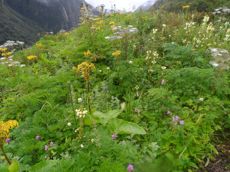
We will be visiting 3 lakes between the passes: the biggest one is Marmi. On the 13th day of the trek we can have natural hot spring bath at Tatopani (2360 m). The most parts of this region are occupied by the hunting reserve so on our pathway we find deer masks, cheetahs too. This place is blessed with wide-ranging natural resources and, biodiversity some of which are varied wild life in the Dhorpatan Hunting Reserve, waterfalls & rivers. The splendid high elevation meadows with the origin site of Yarshagumba, Jatamasi recalls the visitors again and, again; Yarshagumba, also known as mountain Gold an important source of income for the highlands which shows its dual nature: plant and animal. The only hunting reserve of Nepal is the attractive point for most of the tourist. The Himalayan thar is used for hunting recreation in the reserve. It was also a place of camp sites for the Tibetan Refugees.This hunting reserve also introduces us to sacred water taps called Baisdhara (22 water taps) that gives birth to Uttarganga River which joins first to Sani Bheri, secondly to Thulo Bheri and, finally to Karnali River, the longest river of Nepal. Besides being popularly known to be hunting reserve, there is also Bonpo Monastery and, a Tibetan Traditional Medical School. The airport in the hunting reserve is closed since long time. Helicopter alternative to airplane was used in hunting Reserve.
At the initial and the final days, we are able to see villagers on our ways but, in the mid paths we will not meet villagers with exception of June and July. We are able to meet shepherds in these months. If we have enough time, we can go Churen Base Camp from the mid way which will take more 2 days. At this time, we would be on the lap of Putha, which is not the actual base camp. Just after crossing Lamsar, high and sharp mountains (Putha and Dogari) are in front of us as if they can be touched directly with our hands. From Mansoon and Phalyaghar, we can also see the beautiful views of mountains.
Why we worked for its discovery? Our company is committed to exploring new places and the development of the western regions of Nepal. This trek will be a renowned site to trekkers from around the world. We already have GPS data and, how to develop all parts of western region of Nepal. This will be beneficial for followers and new trekkers in this region. Very soon, we will develop map of this region too.
Day to day outline itinerary
Day 01: Kathmandu - Beni ~ 9 hours by Bus
Day 02: Beni – Phalyagaun
Day 03: Phalyagaun - Lulang
Day 04: Lulang - Gurjakhani
Day 05: Gurjakhani to Jharchour
Day 06: Jharchaur to Phalyaghar
Day 07: Phalyaghar to Marmi Parmi
Day 08: Marmi Parmi to Thado Dhogari
Day 09: Thado Dhogari to Phupal Phedi
Day 10: Phupal Phedi to Dule
Day 11: Dule – Tijang - Ranjari
Day 12: Ranjari to Bhanwar
Day 13: Bhanwar to Maurachaur
Day 14: Maurachaur to Lampakha
Day 15: Lamparkha to Tiptara
Day 16: Tiptara-Chhipkhola- Kada
Day 17: Kada to Tasukada
Day 18: Tasukada to Bhati
Day 19: Bhati to Shyarpu Lake
Day 20: Shyarpu Lake to Chinkhet
Day 21: Chinkhet to Dang
Day 22: Dang to KTM
Company Profile
Related Trips
SISNE UPPER Trek
22 Days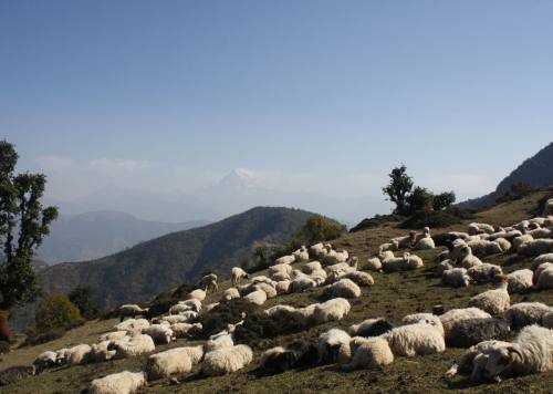
SISNE LOWER Trek
17 Days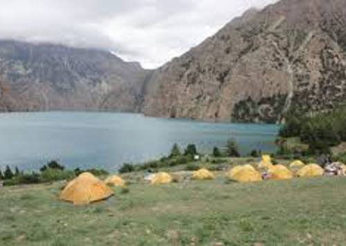
LOWER DOLPO Trek
14 Days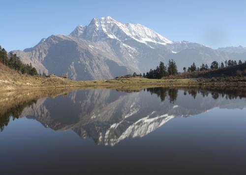
SISNE Trek
15 Days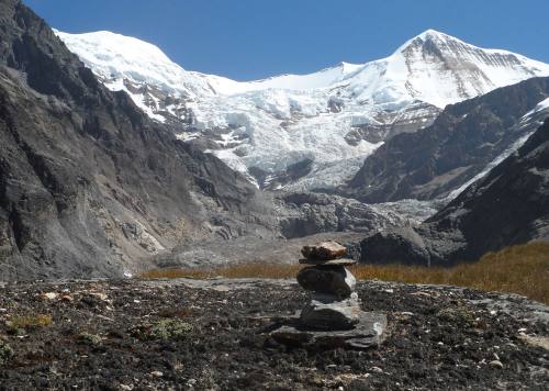
WEST DHAULAGIRI UPPER Trek
22 Days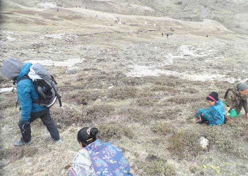
YARSA Trek
16 Days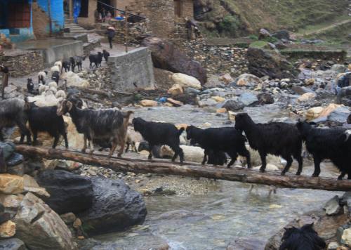
THAKUR JEE or SAI KUMARI Trek
15 Days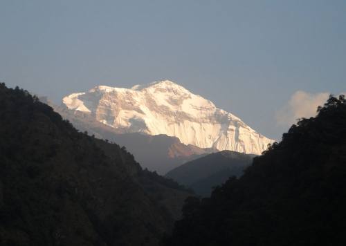
DHAULAGIRI SANCTUARY Trek
14 Days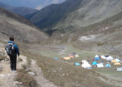
YARSA ROUND Trek
16 Days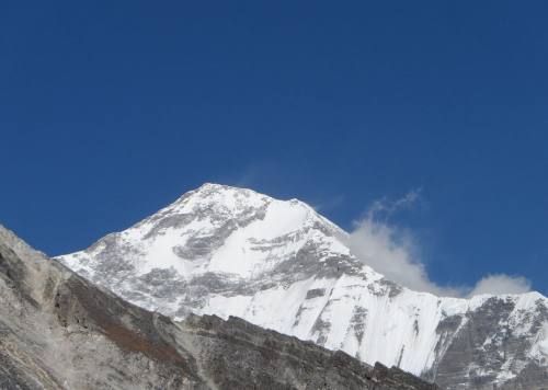
DHORPATAN - SISNE Trek
20 Days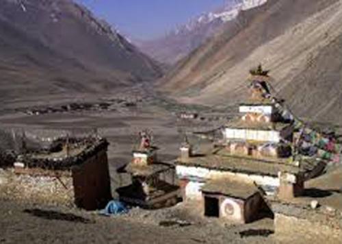
UPPER DOLPO Trek
24 Days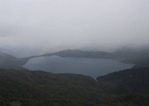
RARA - KHAPTAD Trek
12 Days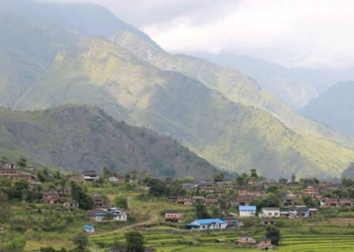
DHAULAGIR ROUND Trek
18 Days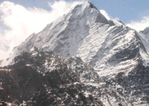
SISNE ROUND Trek
19 Days
Rara Api Saipal Trek
30 Days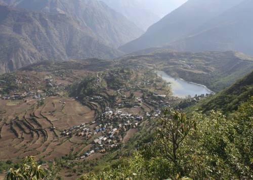
GUERRILLA Trek
20 Days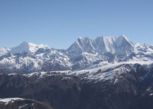
CHAKHURE Trek
14 Days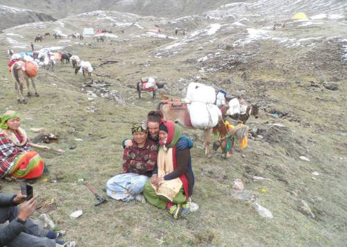
API CULTURAL Trek
18 Days
API KHAPTAD Trek
21 Days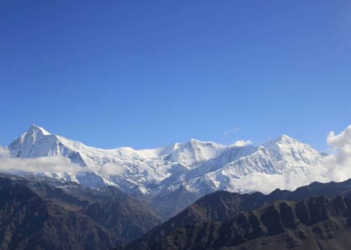
API BASE CAMP Trek
12 DaysWHAT DO PEOPLE SAY ABOUT US?

Inside Rukum paradise
The guerrilla trek provides a total immersion in Magar's community that maintiens its authentic and traditional culture. The homestay experience is unique. Between villages, landscapes from West Dhaulagiri range are magnifient. Discovering Rukum with Man…
- Brigitte and Laurent
ContinueA beautiful trek in autumn
Trekking with Man Dai was really nice and i never felt unsave on the way. It was challenging but we walked for everyone in a good speed! It was a incredible experience and i will…
- Christiane Wolfgruber
ContinueAmazing Trek
Completed the Guerilla Trek September 2022. With Man in charge, things went smoothly as possible in Nepal. He seems to know someone in most remote villages, very useful for fascinating home stays. Incredible scenery with…
- Peter Hoffmann
Continueguerrilla trek
Très beau trek dans le Rukum région situé à l'ouest du Népal . Hors les sentiers battu un périple au milieu de paysages de moyenne montagne ,traversant des villages typiques de culture Magar . Manbahadur,…
- benais
ContinueTowner
Man is the Man! Four of us did this trek along the crests and to the villages and it was epic. No crowds. In fact, we didn’t see any other foreigners in two weeks. Wanna…
- Hank
ContinueApi Base Camp - Rashi Pass - Khaptad National Park
Trekking in Far-Western Nepal was a mix of stunning scenery and rich culture. The trails took us through remote villages and brought us in contact with many friendly locals. The Himalayan views were incredible, and…
- Eric
Continue
Good Experience with Western Nepal Treks
My experience with Western Nepal Treks was amazing! I felt in good hands all the way and could enjoy the landscape and people around. I had nice talk and i learned more about the culture. I…
- Erick
Continue