GUERRILLA TREK
- Duration:20 Day(s)
- Destination:Nepal
- Max. Altitude:Max. Altitude:3915 m, 12,485 ft Phalgune Pass
- Grade:Moderate
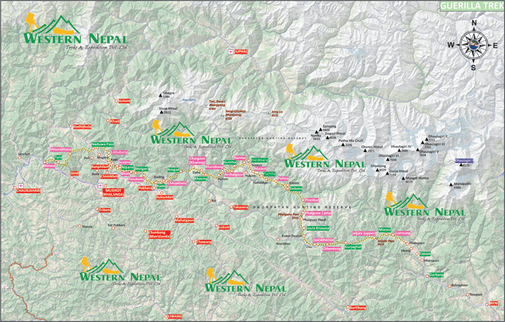
Online Map : Google Earth Pro
With the establishment of comprehensive peace accord in 2006, an attempt making in search of better tourism opportunities at this region, Guerilla Trek was developed at the western part of Nepal. It is also started in order to achieve all- round sustainability development of the people affected during the conflict which included Rolpa, Rukum, Myagdi, Jajarkot and, surrounding districts. Some people who are now members of Western Nepal Treks & Expedition had involved in the vital role to develop the Guerrilla Trek.
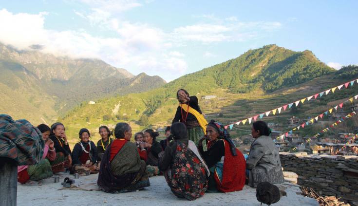
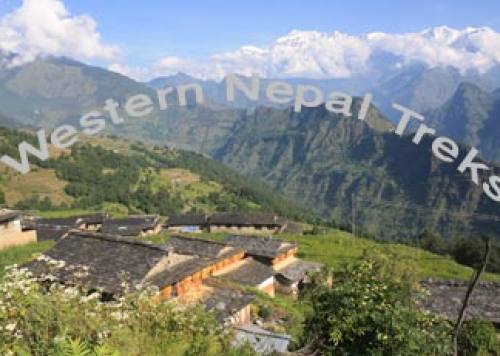
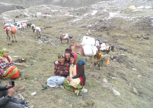
Historical remains of the civilian war in this region are still a fresh. During the civilian war, Rukum and, Rolpa were the main Epicentre for the Nepal’s ten year conflict (1996- 2006) and, were the homeland of many revolutionaries, the period during which had lead to an autonomous Government in their region. On the one hand, Brahmins and, Chhetris took responsibilities of the Public Administration but, on the other hand, Magars, Thapas, Dalits, Gurungs served as revolutionaries for a reformed better Nation. But, the regions now, after the peace accord in 2006, have received immense peace, is beauty and, is always ready to provide warm hospitality to every visitors.
The trek starts from Dharbang and, ends at Syarpu Lake. The trek provides a scenic beauty of the West Dhaulagiri Range. Yarsha Trek, Dhorpatan Trek, West Dhaulagiri Trek, Jaljala Trek lies at the periphery of The Guerrilla Trek.
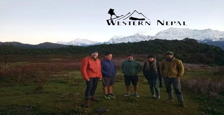
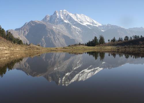
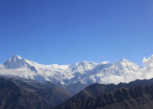
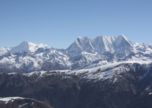
After crossing Myagdi River we arrive at the Jaljala pass (3414 m). From this pass, we receive beautiful sights of Dhulagiri I (8172 m) & West Annapuranarange and, entrance to the Dhorpatan Hunting Reserve that covers Rukum, Myagdi and, Baglungdistrits. This hunting reserve is the attractive point for most of the tourist, the only one hunting reserve of the country. The Himalayan thar is used for hunting recreation in the reserve. This hunting reserve will also introduce us to sacred water taps called Baisdhara (22 water taps) that give births to Uttarganga River which joins first to Sano Bheri, secondly to Thulo Bheri and, finally to Karnali River, the longest river of Nepal. Besides being popularly known to be hunting reserve, there is also Banpo Monastry and, a Tibetan Ayurvedic School.
This place is blessed with wide- ranging natural resources and, biodiversity some of which are varied wild life in the Dhorpatan Hunting Reserve, waterfalls, rivers, eye-catching lakes such as Syarpu Taal, Kamal lake (Lotus). The splendid high elevation meadows with the origin site of Yarshagumba, Jatamasi recalls the visitors again and, again; Yarshagumba being an important source of income for the highlands. Typical of dishes includes daal-bhattarkari, dhirdo, lentil soup and, that of drinks include locally distilled raksi, fermented spirit of chhyang which are usually used indispensably for entertaining guests.
The trek also provides opportunities of hot spring bath at various points of the trek. At Tatopani, there are fine opportunities for the hot water bath and, spring water bath. People have belief that the spring waters are curative although medical facts exists. Meanwhile, many people travel from far distance at this place to enjoy and, spend whole days. Other possible recreation parts in the near future includes paragliding, rafting but due to not enough reiki these sectors have not been explored very well.
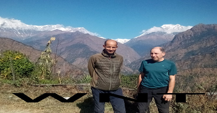
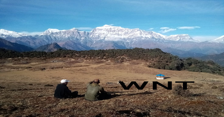
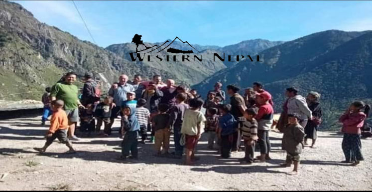
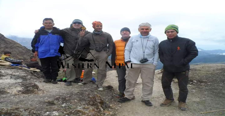
Falgune pass will allow us to have sights of many Himalayas such as Putha (7246 m), Gurga (7193 m), Churen (7371 m), Dhogari (7193 m), which are also known as West Dhaulagiri Range. 2 days after Falgune Pass, we arrive to a beautiful cultural village, Maikot that reflects an ancient fort of Magar clan along with their Kham Culture. The enriched ethnicalso reveals the unique old culture besides new generations of Magar. Kham, a subgroup of Magar has a separate culture with unique language of the Tibetan- Burman Family. Kham culture has the profound recognition in the society.
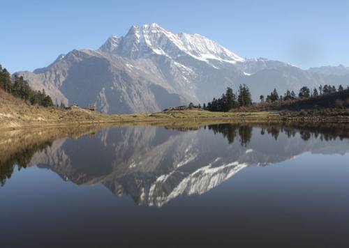
The final pass of the trek, Punam Chautara (2675 m) will provide us an opportunity to see West Dhaulagiri and, the Sisne Himalaya fortifying beautiful landscape of the Rukum Valley. Sisne Himal was for the first time scaled by the explore team ofWestern Nepal Treks and Expedition in 2013. There is a legend that when the peak of Sisne Himal was growing day by day making attempt to touch the heaven, it was chopped down by God; now, the part which separated at another place become Dhaulagiri range.The peak has the shape like that of a fish tail. So, is also commonly known as sister of fish tail (Machhapuchhre Himal of Pokhara city) at this modern time. One day before we arrive to Syarpu Lake, Pokhara Village provides a pleasure of community home stay with local food & culture and, hot water bath at the bank of the Sano Bheri River. Beautiful Pokhara village will lead us to Syarpu Lake. The northern side of the Syarpu Lake provides opportunities of cannoning and, rock climbing. The Syarpu Lake could be a best place to stay few days due to its various recreational opportunities and, famous local fish. In the month of September and, October, the lake turns into bluish color due to post monsoon.
Finally, from the Syarpu Lake, one needs to descend to Lochabang. This area is practicing organic farming and sustainable food programmes. From here, we take bus to Rukumkot. Buses from Rukumkot to Pokhara to Kathmandu are always available.
Withholding unique Kham & native cultures, panoramic views of Himalayas, ancient villages, sacred caves, delightful lakes, magnificent waterfalls, Jaljala pass, Maoist’s historical reviews, Yarshagumba and, region of an immense peace, undoubtedly, The Guerrilla Trek proves as a great pleasure to return visitors and, all Nepal lovers.
Side Trip : Sisne Travarse Route Map kml file
Day to day outline itinerary
Day 01: Ktm - Pokhara to Beni by microbus ~294 Km, 10-12 Hrs
Day 02: Beni to Dharabang (lunch) to Lumsung~ 46km/ 6 hrs.
Day 03: Lamsung to Moreni (Lunch) to Jaljala ~7km/ 6.5 hrs
Day 04: Jaljala to Gurjaghat (Lunch) to Chhentung ~16 km/ 9 hrs
Day 05: Chhentung to Dhorpatan 7 Km/ 2.5 hrs ( half rest day)
Day 06: Dhorpatan to Jaulabishauna (Lunch) to Thankur ~20 Km /10 hrs
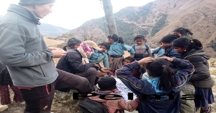
Day 07: Thankur to Dobato (pack lunch ) to Pelma ~13 km/ 8.5 hrs
Day 08: Pelma to Puchhar (Lunch) to Maikot ~11km 6hrs
Day 09: Maikot (rest Day option)
Day 10: Maikot to Jusmur (Lunch) to Ranma ~7 km/ 4 hrs
Day 11: Ranma to Gunma (Lunch) to Archargaon ~8km/ 5 hrs
Day 12: Archalgaon to Kharabang (Lunch) to Punam Chautara ~8 km/ 7 hrs
Day 13: Punam Chautara to Viewpoint (Lunch) to Chargaon ~15km/ 9hrs
Day 14: Chargaon to Naigad (Lunch) to Chhipkhola ~14 km /7hrs
Day 15: Chhipkhola to Dhaka (Lunch) to Rukum Pokhara ~ 9.5km /5hrs
Day 16: Rukum Pokhara to Kunakhet (Lunch) to Shyarpu Lake ~17 km / 9 hrs
Day 17: Shyarpu Lake to Harlabot or Lochhabang (Lunch) to Chhinkhet ~5 km/ 3 hrs
Day 18: Chinkhet to Musikot (lunch)~15 Km/ 1.5 hrs - Rukumkot ~38 km / 3 hrs by Local Jeep
Day 19: Rukumkot to Pokhara by normal bus ~245 km/ 12 hrs
Day 20: Pokhara to KTM by Tourist bus -205km ~9-10 hrs
Cost Details
Cost Include
- Vehicle transportation to and from your trip arrival point, for example, from Kathmandu’s Tribhuvan International Airport to your hotel in the city.
- Clean and comfortable accommodation in Kathmandu and Pokhara (breakfast meals are included).
- A sightseeing tour of Kathmandu Valley with a professional guide and entrance fees to World Heritage Sites, Palace Squares and historic temples.
- Breakfast, lunch and dinner during the journey.
- Tea–house lodging during journey.
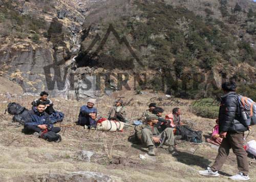
- Trained, certified and experienced guide with assistants (we typically have one porter per two trekkers).
- Fees for entering the Dhorpatan Hunting Reserve.
- Trekker’s Information Management System (TIMS) card as necessary.
- First Aid Kit and supplies.
- Farewell Dinner following the journey -- typically, on the eve of your international departure.
* Cost At a Glance : local Food, local Accomodation, English Speaking guide.
Cost Include
Cost Exclude
- International travel to and from Nepal.
- Major meals other than breakfast while staying in Kathmandu and Pokhara.
- Personal Expenses (for example, laundry expenses, extra drinks and extra snacks, telephone calls).
- Personal clothing and gear.
- Personal toiletries.
- Travel Insurance and Medical Insurance with rescue coverage.
- Extra fees at tea-houses and trailside lodges (for example, extra fees for recharging electronic equipment, alcoholic drinks, laundry).
- Tips for crew and staff along the journey.
- Unforeseen expenses due to cancellation of events and activities because of circumstances beyond our control (for example, weather delays, trail changes, political disruptions, illness of a group member and similar events beyond our control).
* Cost At a Glance : Flight ticket
Cost Exclude
Detail Itinerary
Day 01Ktm - Pokhara to Beni by microbus ~294 Km, 10-12 HrsKtm -Pokhara ~205 Km/ 8 Hrs- Pokhara - Beni~83 Km/ 4 hrs.
Coordinate : kathamandu 27 .43.01 N &85.18.54E , Pokhhara 28.12.46N &83 .58.31E , Beni 28.342437, 83.56.46Beni
Normally, it takes 7 to 8 hrs to reach Pokhara from Kathmandu which is 205 Km but , now Govt. is expanding road upto Pokhara, so it takes 9-10 hrs which makes our trek little bit longer. Pokhara to Beni is 87 Km/ 2 to 3 hrs. For accommodation, we recommend Hotel Hill View (cont. No. 9851630278).
Day 02Beni to Dharabang (lunch) to Lumsung~ 46km/ 6 hrs.Beni -Dharabang (lunch)~25 Km/2 hrs - Dharapani - Takam - Muna by Jeep ~16 Km/ 2hrs then trek to Lumsung~5 km/ 2 Hr
Coordinate : Darbang28.25.04N&83.22.42E, Darapani 28.27.27N& 83.22.16E ,Takam28.28.23 N & 83.21.22.,Muna 28.30.15N &83.19.17E, Lamsung 28.31.05N&83.15.53N
At Beni, after having breakfast, we will have lunch at the local tea house, close to the bridge at Darbang . on the way to Lumsung you will have beautiful view of Dhaulagiri I including Gurja and other mountains and many aesthetic local villages where, Lumsung offers you a homestay service in Crystal Mountain (Cont. no: 9862443559).
We recommend to buy Fruit at the place where you had your lunch before.
Day 03 Lamsung to Moreni (Lunch) to Jaljala ~7km/ 6.5 hrs Lamsung - Moreni (Lunch) ~3 Km/ 2.5 hrs - Jaljala ~4km/ 4 hrs
Coordinate :Morani 28.31.12 N&831553E, Jaljala 28.30.40 N&83.14.17E .
After having breakfast at Lumsung, we have lunch at Morani in Apple Garden home Stay 2500 m (Mobile number 9845260117) with perfectly clean and tidy with Mountain view of Mt. Gurja Himal, After having lunch, we ascend up and reach Jaljala at 3400 m one of the best Panoramic view of Nepal . In spring season, we need to reach lower Jaljala~2 km/0.5 Hr from the camping site in order to fetch water but Autamam season enough water Near camping Places.
Day 04Jaljala to Gurjaghat (Lunch) to Chhentung ~16 km/ 9 hrs Jaljala- Gurjaghat (Lunch) ~10 Km/ 5.5 hrs - Chhentung ~6 km/ 3hrs.
Coordinate: Gurjaghat 28.29.53N83.09.19, Chantung28.29.37N83.05.58E
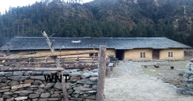
Jaljala to Gurjaghat have a nice trekking trail and along the river .and There is local seasonal house at Gurjaghat Indra dai(9867697807)lokandra (986733453) They open the Tea hose for the Season but closed in Nov 15 to Feb15 .After Gurjaghat .After the lunch we can go to Chantung by following Same river and we can Stay at Bisnu Thapa's (9867846298) Home stay . In his house the Capacity is only for 6 guest so if we have more 6 guest we need to go Dhorpatn 2.5 hrs far from Chantung .
Day 05Chhentung to Dhorpatan 7 Km/ 2.5 hrs ( half rest day) Chhentung - Dhorpatan ~7 Km/ 2.5 hrs.
Coordinate: Dhhorpatan 28.29.33N& 83.03.06E
Chantung is a historical place for the Tibiten Refugee during China Tibet war still there Tibitten People and monestry and Tibitten herbal medicine seasonal school. Chantung to Dhorpatan there lots of sight seeing like Utttar Gange sourse to take Holi bath , horse riding ,Banpo culture. When you arrive Dhorpatan, there is so many hotel(48) but we will recommend a community lodge for the confortness.
Day 06Dhorpatan to Jaulabishauna (Lunch) to Thankur ~20 Km /10 hrs Dhorpatan - Jaulabishauna 5 km /3.5hrs - Bheda Kharka ~2.5km/1hr (Lunch)- Falgune pass (4100m)~ 5.5 km/3hrs - Thankur ~7 Km/ 2.5 hrs.
Coordinate :Jaulabisauna 28.31.31N82.01.80E& Falgunepass 28.33.53N 830128E ,Thankur 28.36.21N83.01.44E
From Dhorpatan to Jaulabisauna is really near; so it would be nice to have tea break rather than having lunch then few hour later at Bheda kharka, we can have pack Lunch before crossing Falgune Pass 4100 m. There is next option that if we don't take rest at Dhorpatan, we can save one day trekking directly from Chantung to behind Falgune pass(3900m ) & close to a small water creek, we can set up our camp from where we can see panoramic views of West Dhaulagiri in the early morning. Our main trek plan from Dhorpatan to Thankur is only 7 km from this alternative Camp site. When we arrive Thankur, there is really minimum facility of Accommodation and food. Most of time, we have to stay shepherd's shelter( Bhedi Goth). If you are lucky some time there would seasonal tea house. But not sure so you need to travel here with two choice either staying at seasonal Shepard's house or set up the light tent there only.
Day 07Thankur to Dobato (pack lunch ) to Pelma ~13 km/ 8.5 hrs Thankur - Ghustung Riverside (Tea Shop) 3.km/ 1.5 hrs - Dobato (Pack lunch) 5km /3.5hrs -Pelma ~5.km 3 hrs.
Coordinate :Dobato 28.37.59N82.58.36E Pelma28.29.35E82.56.45N
On the way to Thankur to Pelma, near to Ghustung khola bridge, there is a tea shop for having Lunch which seems too early to take so it's better to have pack lunch here only and have it at Dobato. Dobato is new Junction of Pelma and kayam Dada but there is no water so It's advised to carry water for Dobato and up to Pelma pass. When we arrive Pelma, we can have Natural hot spring bath, which is only 20 minutes far from Pelma village via viral suspension bridge. Now, here you can chose home stay at Pelma out of some available Home Stay, we will rest at Pelma Home stay (mob. no.: 9867913551)
Day 08Pelma to Puchhar (Lunch) to Maikot ~11km 6hrs Pelma - Puchhar ~7.5 km/ 4 hrs (Lunch) - Maikot ~3.5 km/ 2 hrs
Coordinate : Puchar 28.40.01N82.54.19E ,Maikot 28.40.29 N 82.52.47 E
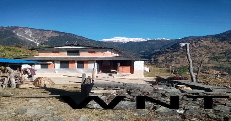
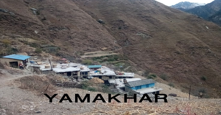
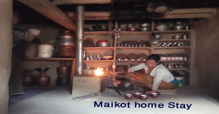
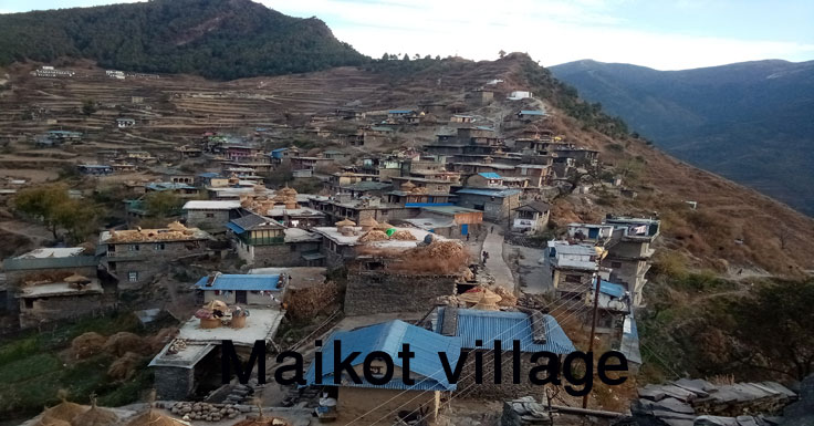
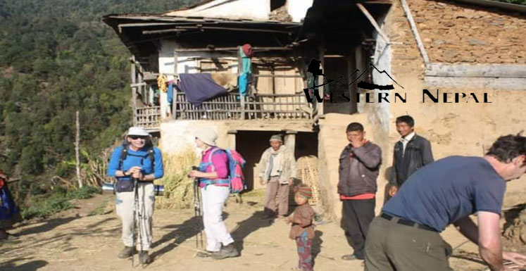
Travelling from Pelma to Maikot you will cross the Yamkhar village and after few hours of trek, we will have lunch at puchhar vallge which continues to a historical village of Magar in Maikot. Only for advise: Yamkhar Village is the oldest trail junction for Maikot village and Dolpa. Arriving Maikot, we really have a nice Maikot home Stay (mob no.:9843832592) for accommodation & food.
Day 09Maikot (rest Day option) Maikot is a Historical place for Magar culture & the origin of Kham language and is a open Musiem for trekkers so it's worth to to stay one day here.
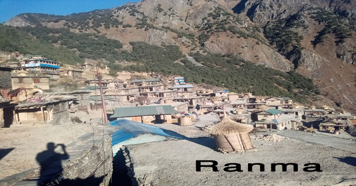
Day 10Maikot to Jusmur (Lunch) to Ranma ~7 km/ 4 hrs Maikot - Jusmur 0r Hardibang (Lunch) ~3.5km/ 2hrs - Ranma ~3.5 km/ 2hrs
Coordinate: Jusmur 284145N&825214E,Hardibang 28.42.01N825213N Ranma 28.42.01N82.51.28E
While trekking towards Ranma we can have lunch to Maikot or contact the person for lunch at Jusmer but at Ranma there is availability of some home stay and is also a nice and cultural place like Maikot but have less movement.
Day 11Ranma to Gunma (Lunch) to Archargaon ~8km/ 5 hrs Ranma - Gunma (Lunch) ~ 5.5 km/ 3 hrs - Archalgaon ~2.5 km/ 2
Coordinate : Gunma284133N 424913E,Archalgaun 28.40.44E82.48.57E
Trekking from to Ranma to Archalgaun is a short trek. We can have lunch (Mob no.: +9779746526923) at Ghunma village and stay night at Archalgaun (Mob. no.: +9779864364123) but, sometimes some clients also choose to have lunch at Archalgaon and go to Kharabang directly.
Day 12Archalgaon to Kharabang (Lunch) to Punam Chautara ~8 km/ 7 hrs Archargaon - Riverside ~3.5 km/ 3 hrs - Kharabang(Lunch) ~2 km/ 1.5 hrs - Punam chautara ~2.5 km/
1.5hrs.
Coprdinate: Khhola 28.41.12&N424740E, kharabang 28.40.28N82.47.29E,Punam Chautara 28.29.55N824658E
Trekking from Archalgaun to Punam Chautara, you can have your lunch either at River side or kharabang. For the river side, we have to make order in advance for the lunch but at kharabang (Mob. no.: +9779846310476) you can make phone calls anytime. If you want to stay at Kharabang there's also a nice facility and warm hospitality of Harka prakash Rokas's House (Mob. no.: +9779846310476), where our main plan was to stay at Punum Chautara to maintain our trek distance & timing. At Punam Chautara also, there is two options to choose for camping. Arriving at Punam Chautara there is a Camping site on the playground, near to a small creek where, you can make phone call to Didi ( Mob. no.: +9779861144315). Another option: on the top of Punam Chautara village, there is a local house (Mob. no.: +9779749434650) where we used to stay while carrying out our explorations but, needs to get improve a lot for the home stay.
Day 13Punam Chautara to Viewpoint (Lunch) to Chargaon ~15km/ 9hrs Punam Chautara - Viewpoint (Lunch) ~8.5 km/ 6hrs - Chargaon ~6.5 km/ 3 hrs .
Coordinate : khasing view point 28.40.08N&42.44.37E,Daha 28.40.39N42.43.46E Chargaun 28.41.14N82.42.27E
After having breakfast at Poonam Chautara, we can go behind the Khasing pass for Lunch from where we can see Panoramic view of Sisne Himal. At the pass there is supply of drinking water but there is no regularity of drinking water so, it's better to go lower view point or Daha for pack lunch. After having pack lunch, we can go to Chargaun Village in 3 hrs for the stay(mob. no.: +9779864988067). It's advised to spend best time with local food and local chickens here after completing all high passes then plan option to go Directly to Rukumkot in next day to shorten our trek days.
Day 14Chargaon to Naigad (Lunch) to Chhipkhola ~14 km /7hrs Chargaon - Naigad (Lunch) ~6.5 km/ 3 hrs - Chhipkhola ~7.5 km/ 4 hrs.
Coordinate:Naigad 28.40.43N82.40.45E Chhipkhola 28.29.04N82.37.45E
Trekking from Chargaun to Chhipkola, we can have lunch at Naigad. Naigad is the junction of Rukumkot and Sisne to Dolpo, where we have good access to eggs, Chickens, drinks, juice. While going from Naigad to Chhipkhola, there is a bheer( cliff) that one may receive dizzy: the trail is very narrow so we may probably have to decide an alternative trail to go directly to Rukum Pokhara. Chhipkhola is the first commune practiced with a commune school too.
The villages are beautiful with Homestay facilities here, but these homestays need to be improved as well. The homestay of Tharu didi (Mob. no.:+9779842367306) and, next one home stay is ... (Mob. no.: +9779769950296). You can also order here for local sisno & dhindo. All houses have carried out buffalo husbandry. The village have well irrigation, electricity, school, internet, creek bridges, roads & other infrastructures too for a luxurious life that of town.
Day 15Chhipkhola to Dhaka (Lunch) to Rukum Pokhara ~ 9.5km /5hrsChhipkhola - Dhaka (Lunch) ~6km/ 3 hrs - Rukum Pokhara ~3.5km /2hrs
Coordinate :Dading 28.39.04N&82.37.45E Dhaka 28.38.30N&82.3615E Rukum Pokhara 28.38.09.N&82.05.02E
Local houses (Mob no.: +97798578242280 - House of Mahesh kc) are tourist friendly than the hotel itself with facilities of hot spring, hospital, shopping centre is very close, warm weather, the village is close to the Sani Bheri river.
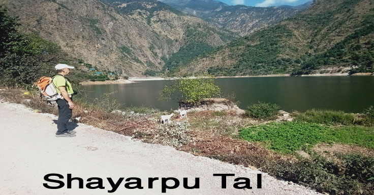
Day 16Rukum Pokhara to Kunakhet (Lunch) to Shyarpu Lake ~17 km / 9 hrs Rukum Pokhara - Kunakhet (Lunch) ~9 km/ 5 hrs - Shyarpu Lake ~8 km/ 4 hrs
Coordinate :Danichaur 28.38.56N&823246/Pipal, Kunakhet 282944N&82.30.53E,Koalchaur 28.40.13 N &823014E ,Shayarpu Tal 284125N &82.29.04E
The route is a bit long. We will have lunch at the river side. The trail is steep uphill till Shyarpu. Good refreshment at the Shyarpu Lake with fish, hotel accommodation, boating in the lake. We recomend Yagya Chanda's Home Stay (Handy ........) for food & accommodation. The Shyarpu lake really holds bright future too. But, in March & April, the lake gets dry. Banfikot is the first autonomous unit, declared by Moaist in Nepal.
Pokhara to Kunakhet is a popper place to have to lunch with some shop, house and normal standard hotels
Day 17Shyarpu Lake to Harlabot or Lochhabang (Lunch) to Chhinkhet ~5 km/ 3 hrsShyarpu Lake to Harlabot or Lochhabang (Lunch) to Chhinkhet ~5 km/ 3 hrs
Coordinate : Harlaboth 28.40.58N 82.27.34E ,lochabang ...... Chhinkhet28.40.&N822734E
Within the forest of Harlabot, we will find houses, organic food, irrigation, electricity facilities. and magar & chhetri communities at Lochhabang settlements & hotels at chhinkhet from where we can take transportation facilities.
Charpu lake to Harlaboth./Lochabang is not so far but, it's better to stay here for last day in organic village @ harlaboth Man bahadur khatri house or Lochabang Joke Bahadur pun house or if you want stay in Bazzar chinkhet hotel also available .
Day 18Chinkhet to Musikot (lunch)~15 Km/ 1.5 hrs - Rukumkot ~38 km / 3 hrs by Local Jeep Chhinkhet to Musikot (Lunch) ~15 km / 1.5 hrs by private jeep - Rukumkot ~38km/ 3 hrs by private jeep
Coordinate: Musikot 28.37.44N&28.37.44E Rukumkot 28.37.01N&823732E
Musikot (Khalanga) is the headquarter of Rukum district, you can stay tonight here but it's better to go Rukumkot which is a touristic city too.
A total distance of 15+38=53 Km from Chhinkhet to Rukumkot can be followed with two trails: one to go via river side and the other to reserve a jeep & local bus going from Musikot/ Khalanga. In Rukumkot, you'll have some good hotels to choose like Hotel Kamal Daha,(98435221902)Hotel Lake City,( 9851061082)Hotel BLB () Hotel Managya for food and accommodation.
Day 19Rukumkot to Pokhara by normal bus ~245 km/ 12 hrsRukumkot - Burtibang- Pokhara by normal bus ~245 km/ 12 hrs
Cordinate:Burtibang28.19.21N&83.09.36E
Usually, bus starts at 10:30 so, it's better to arrive Rukumkot at 10 pm and, also to take heavy breakfast before you leave for the journey and so many hotel to stay via middle highway.
Day 20Pokhara to KTM by Tourist bus -205km ~9-10 hrsPokhara to KTM by tourist bus ~205km/ 9-10 hrs
Coordinate: Pokhara 281213N&835979E kathamandu 274301N&851854E
Now, Road is under widening by the Road Division of the Nepal Govt. so, these days, it's taking longer time than the usual where, the ususal time was 7hrs.
Cost Include
- Vehicle transportation to and from your trip arrival point, for example, from Kathmandu’s Tribhuvan International Airport to your hotel in the city.
- Clean and comfortable accommodation in Kathmandu and Pokhara (breakfast meals are included).
- A sightseeing tour of Kathmandu Valley with a professional guide and entrance fees to World Heritage Sites, Palace Squares and historic temples.
- Breakfast, lunch and dinner during the journey.
- Tea–house lodging during journey.
- Trained, certified and experienced guide with assistants (we typically have one porter per two trekkers).
- Fees for entering the Dhorpatan Hunting Reserve.
- Trekker’s Information Management System (TIMS) card as necessary.
- First Aid Kit and supplies.
- Farewell Dinner following the journey -- typically, on the eve of your international departure.
* Cost At a Glance : local Food, local Accomodation, English Speaking guide.
Cost Include
Cost Exclude
- International travel to and from Nepal.
- Major meals other than breakfast while staying in Kathmandu and Pokhara.
- Personal Expenses (for example, laundry expenses, extra drinks and extra snacks, telephone calls).
- Personal clothing and gear.
- Personal toiletries.
- Travel Insurance and Medical Insurance with rescue coverage.
- Extra fees at tea-houses and trailside lodges (for example, extra fees for recharging electronic equipment, alcoholic drinks, laundry).
- Tips for crew and staff along the journey.
- Unforeseen expenses due to cancellation of events and activities because of circumstances beyond our control (for example, weather delays, trail changes, political disruptions, illness of a group member and similar events beyond our control).
* Cost At a Glance : Flight ticket
Cost Exclude
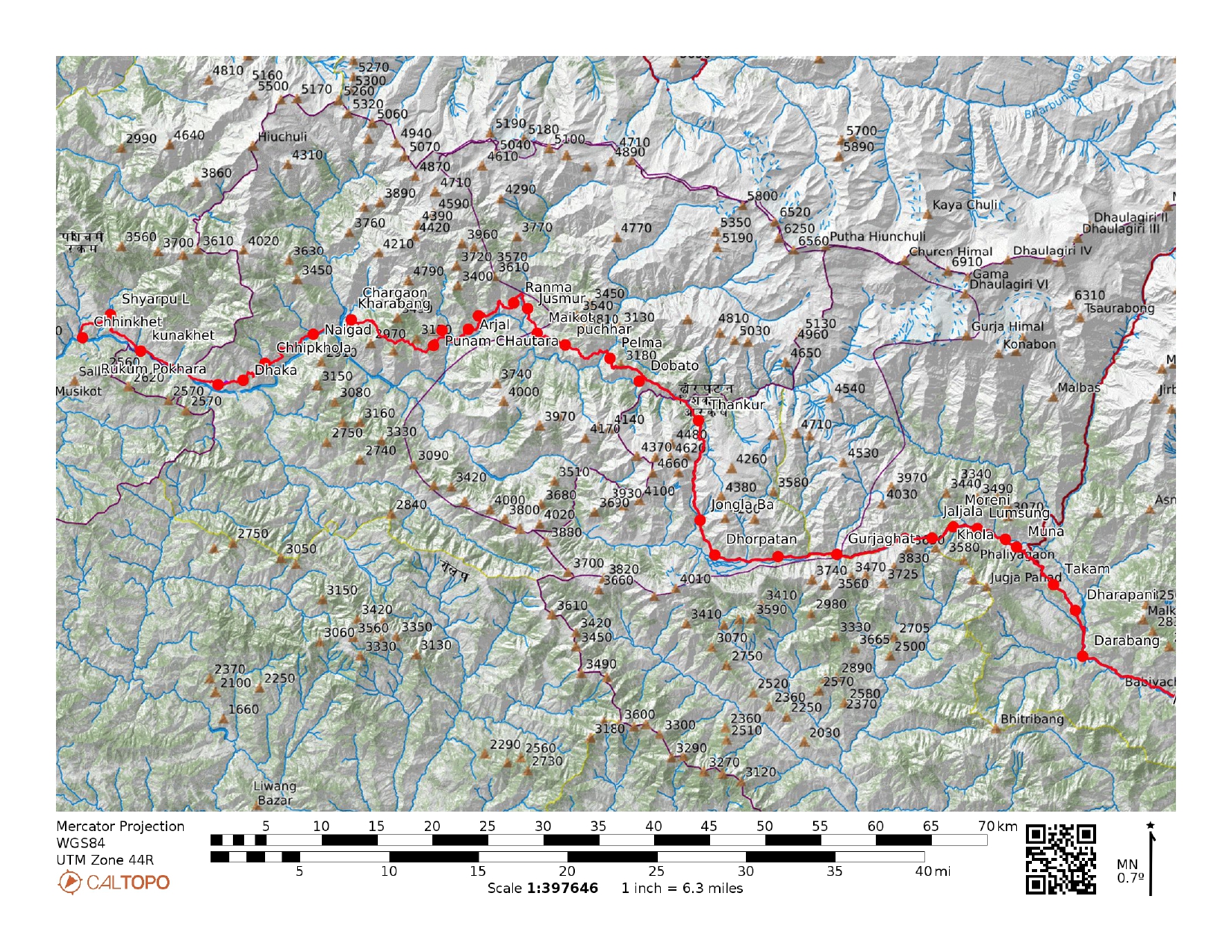


Trip Map
Company Profile
Related Trips
SISNE UPPER Trek
22 Days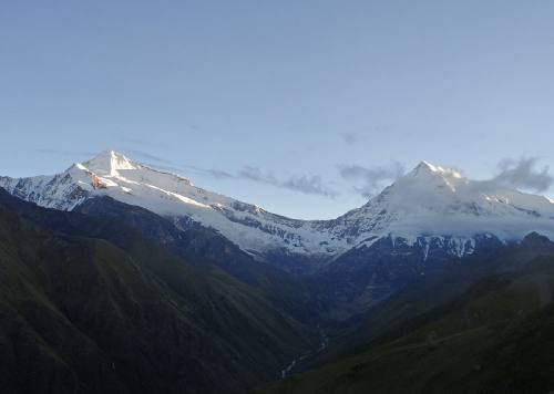
WEST DHAULAGIRI LOWER Trek
22 Days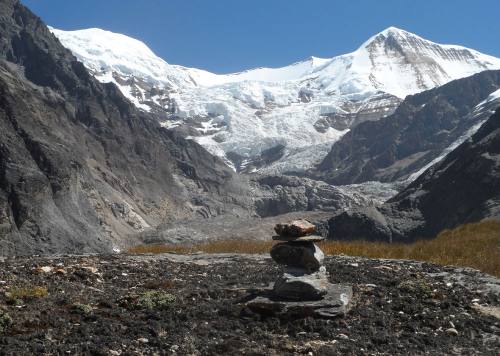
WEST DHAULAGIRI UPPER Trek
22 Days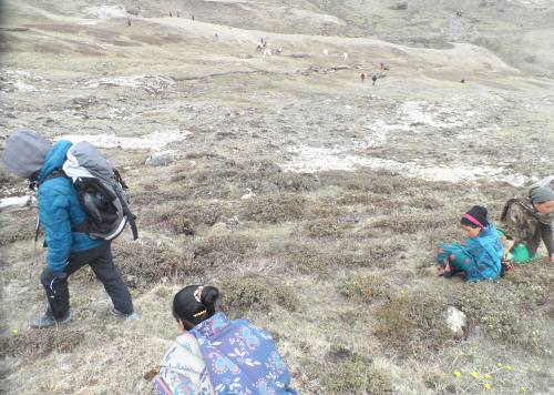
YARSA Trek
16 Days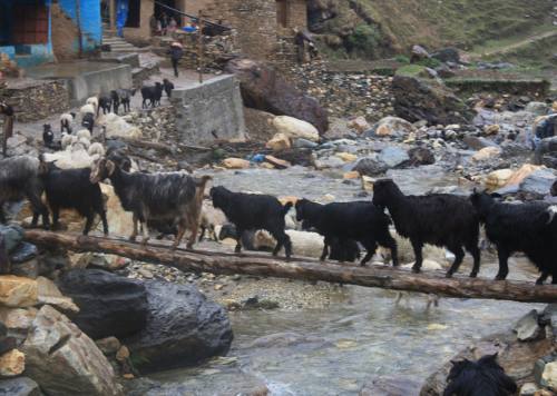
THAKUR JEE or SAI KUMARI Trek
15 Days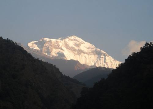
DHAULAGIRI SANCTUARY Trek
14 Days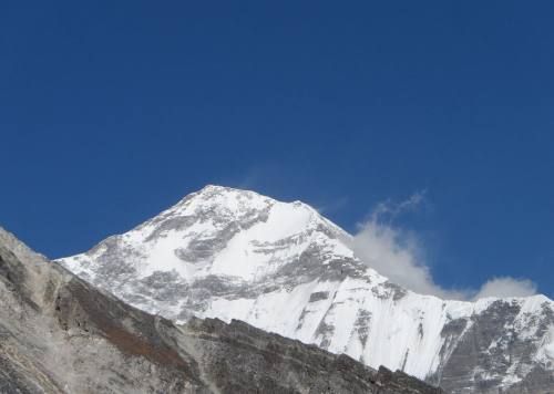
SISNE TREK
15 Days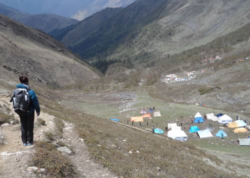
YARSA ROUND TREK
16 Days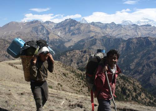
DHORPATAN - SISNE TREK
20 Days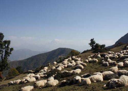
SISNE LOWER TREK
17 Days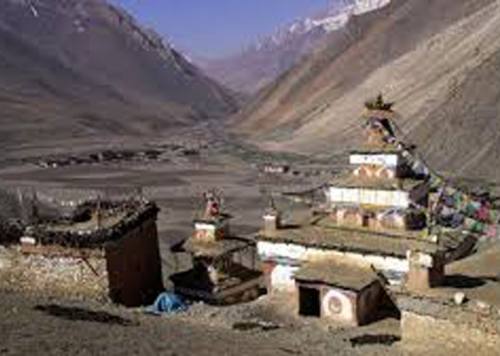
UPPER DOLPO TREK
24 Days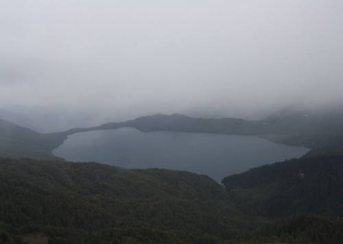
RARA - KHAPTAD TREK
12 Days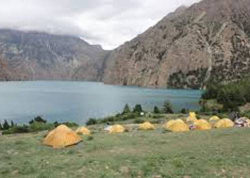
LOWER DOLPO TREK
14 Days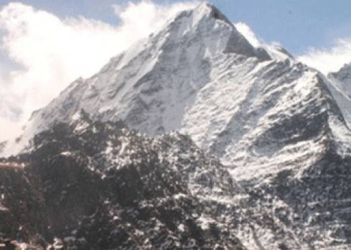
SISNE ROUND TREK
19 Days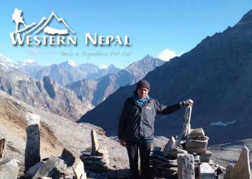
API SAIPAL BASE CAMP TREK
28 Days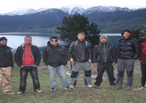
API KHAPTAD TREK
21 Days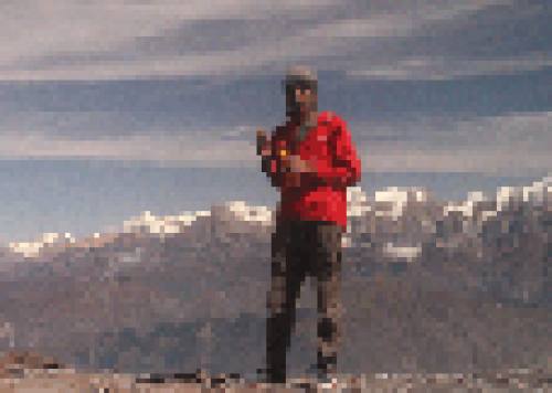
Sisne -Phoksundo Trek
16 Days
SAIPAL ROUND TREK
30 Days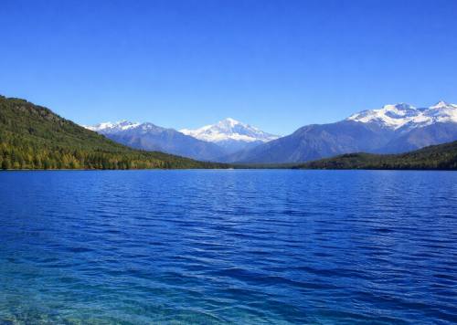
Phoksundo to Rara Trek
23 Days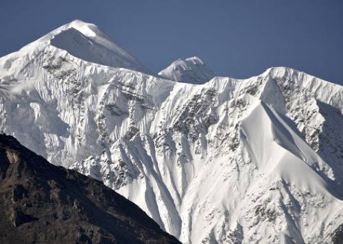
Dhorpatan Treks
14 Days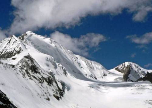
API BASE CAMP TREK
12 Days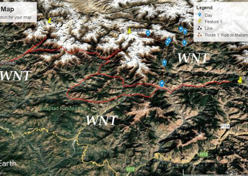
API CULTURAL TREK
17 Days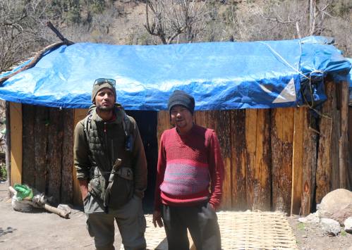
CHAKHURE TREK
14 Days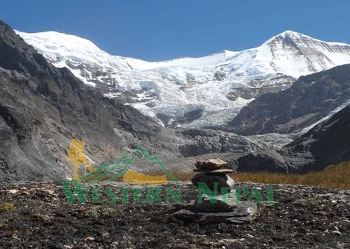
West Dhaulagiri Base Camp Trek
17 Days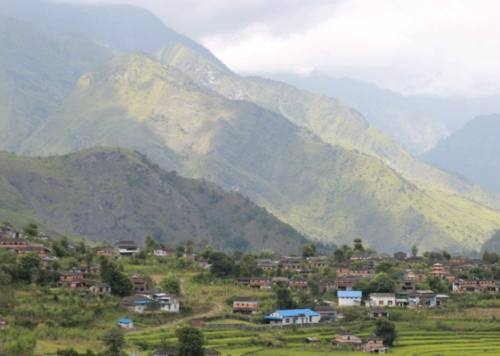
DHAULAGIRI ROUND Trek
18 DaysWHAT DO PEOPLE SAY ABOUT US?
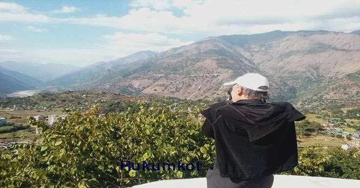
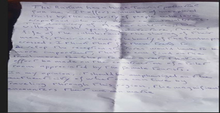
Inside Rukum paradise
The guerrilla trek provides a total immersion in Magar's community that maintiens its authentic and traditional culture. The homestay experience is unique. Between villages, landscapes from West Dhaulagiri range are magnifient. Discovering Rukum with Man…
- Brigitte and Laurent
ContinueA beautiful trek in autumn
Trekking with Man Dai was really nice and i never felt unsave on the way. It was challenging but we walked for everyone in a good speed! It was a incredible experience and i will…
- Christiane Wolfgruber
ContinueAmazing Trek
Completed the Guerilla Trek September 2022. With Man in charge, things went smoothly as possible in Nepal. He seems to know someone in most remote villages, very useful for fascinating home stays. Incredible scenery with…
- Peter Hoffmann
Continueguerrilla trek
Très beau trek dans le Rukum région situé à l'ouest du Népal . Hors les sentiers battu un périple au milieu de paysages de moyenne montagne ,traversant des villages typiques de culture Magar . Manbahadur,…
- benais
ContinueTowner
Man is the Man! Four of us did this trek along the crests and to the villages and it was epic. No crowds. In fact, we didn’t see any other foreigners in two weeks. Wanna…
- Hank
ContinueApi Base Camp - Rashi Pass - Khaptad National Park
Trekking in Far-Western Nepal was a mix of stunning scenery and rich culture. The trails took us through remote villages and brought us in contact with many friendly locals. The Himalayan views were incredible, and…
- Eric
Continue
Good Experience with Western Nepal Treks
My experience with Western Nepal Treks was amazing! I felt in good hands all the way and could enjoy the landscape and people around. I had nice talk and i learned more about the culture. I…
- Erick
Continue